5.2.1. Create OcTree Mesh
Here, the code create_octree_mesh_e3dmt.exe and the input file octree_mesh.inp (see format) are used to create an OcTree mesh based on the set of observation location and surface topography. In our case, we set the topography to have a constant elevation of 0 m. Files relevant to this part of the example are in the sub-folder octree_mesh. Before running this example, you may want to do the following:
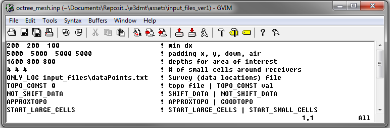
To generate the OcTree mesh, the following input file was used:
The resulting OcTree mesh and surface topography are shown below.